Paris RER Map 2024
(If you prefer the old style RER map with only RER lines & zones click here).
The Paris Regional RER train system connects major tourist destinations and ports of entry to the heart of Paris, near St. Michel – Notre Dame.
Paris RER Train Map
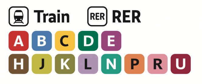
Here is a detailed Paris RER train map of all RER lines A thru E, plus Transilien “Train” lines H thru U, Paris Metro lines 1-14 and Tram lines 1-11 in and around the surrounding suburbs.
Fare Zones
Unlike the Paris Metro system which is all one zone (yet goes across three Zones), the Paris RER trains have 5 Zones all around the Ile-de-France, the area which surrounds Paris. It’s important your RER ticket or Paris transit pass has valid zone coverage. The new 2024 Paris RER Map doesn’s show fare zones. To see all 5 Paris Fare Zones please see the RER Zone map page.
Popular RER Routes
- Roissy-Charles de Gaulle (CDG) Airport Terminals 1 & 2 to Paris – RER B (Blue)
- Paris-Orly (ORY) Airport to Paris – RER B (Blue) / Orly Val
- Paris to Versailles – RER C (Yellow)
- Paris to Chateau de Vincennes – RER A (Red)
- Paris to La Défense – RER A (Red)
- Paris to Gare du Nord (for Eurostar to London) – RER B (Blue) or RER D (Green)
- Paris to Disneyland – RER A (Red)
Download latest Paris RER Map 2024 (PDF) (courtesy of Ile-de-France Mobilités)
Download Simplified Paris RER Map (PDF) (courtesy of RATP)
What Next?
- Search:
- Ask a question

I want to support Ben
Pingback: Paris by Train · Paris Metro RER Map
Pingback: Paris by Train · Paris RER C Schedule