Here you can download a Paris Bus Map showing all Paris city bus lines throughout central Paris in PDF format (1.6 MB).
Paris Bus Map – PDF download 1.6 MB
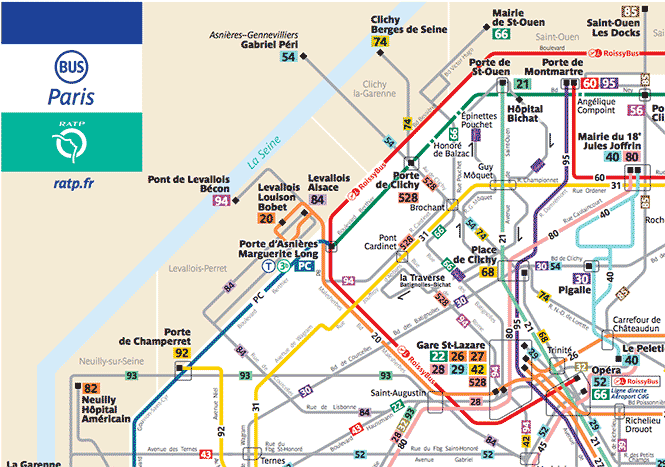
This Paris Bus Map also shows tram lines around the circumference of Paris city center.
Black squares on the map are terminus bus stations where Paris bus lines begin & end service for that bus line.
Individual bus stops are not shown on this Paris bus map, just the route the Paris bus line will take, with major street names shown along the bus line.
Major Paris bus connections and interchanges are outlined by a grey line surrounding the area the Paris bus transfer / connections can be made.
For specific information on Paris airport buses, see the CDG Airport bus article and Orlybus Orly airport bus article.
Paris Buses use the Paris Bus-Tram ticket, as of 2025.
What Next?
- Search:
- Ask a question

I want to support Ben