Below are all 16 Paris Metro line maps showing all stations along each Paris Metro line.
Paris Metro line maps also show connections to:
- other Paris Metro train lines
- major tourist attractions (Eiffel Tower, Louvre, etc.)
- Paris RER trains (RER A, B, C, D, E)
- major Paris train stations (Gare du Nord, Gare Saint Lazare, etc. and other Gare Grandes Lignes)
- Airport bus lines Roissybus & Orlybus
- Ter regional train lines
- TGV & other high speed train lines both national & international trains (Eurostar, Thalys, ICE, AVE, etc.)
- Intercites train stations (national trains)
- Transilien suburban trains (Transilien H – U)
- Paris Tram lines T1-T8
Paris Metro lines are numbered 1 to 14 with two short secondary extension lines 3bis and 7bis for a total of 16 Paris Metro lines.
Paris Metro line 7 and Metro line 13 branch near their suburban end for two separate terminus stations. Because of this Metro line branching on line 7 / lin 13 you’ll need check the overhead platform signs showing which branch is being served by the next Metro train.
Paris Metro Line Maps 1 – 14
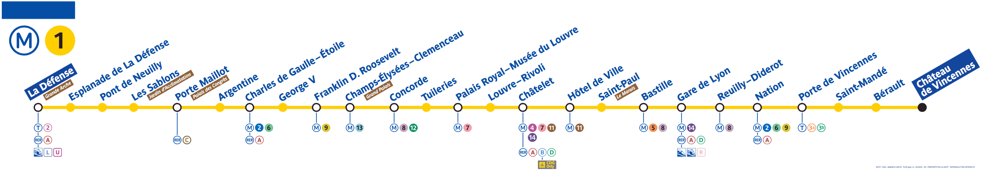
Paris Metro line 1 Map
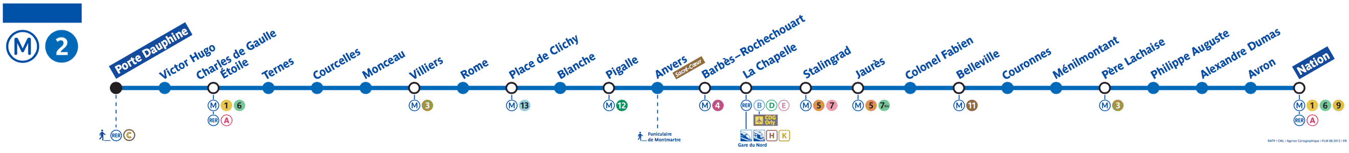
Paris Metro line 2 map

Paris Metro Line 3 Map
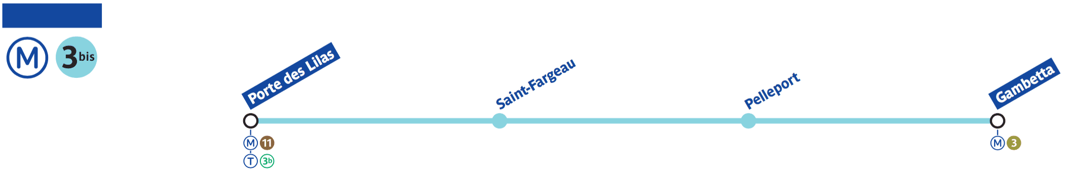
Paris Metro line 3bis map
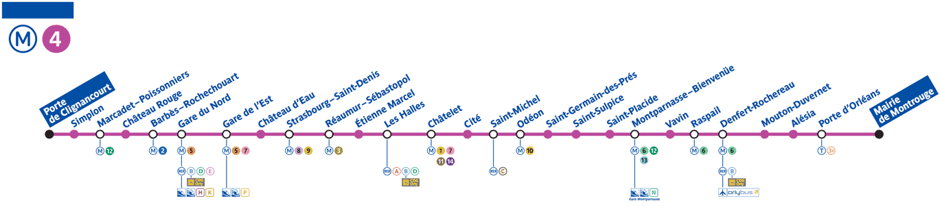
Paris Metro Line 4 Map
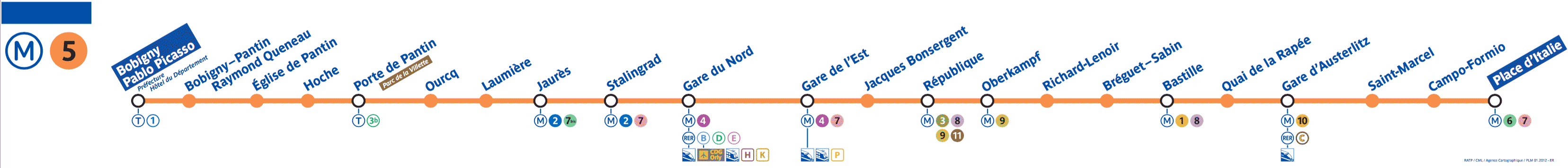
Paris Metro line 5 map
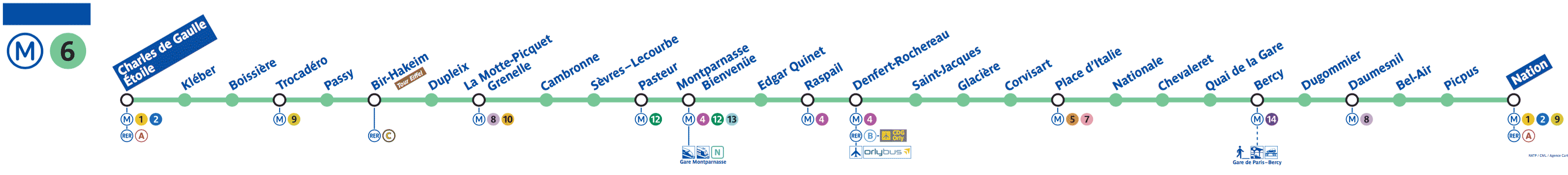
Paris Metro Line 6 Map

Paris Metro Line 7 Map
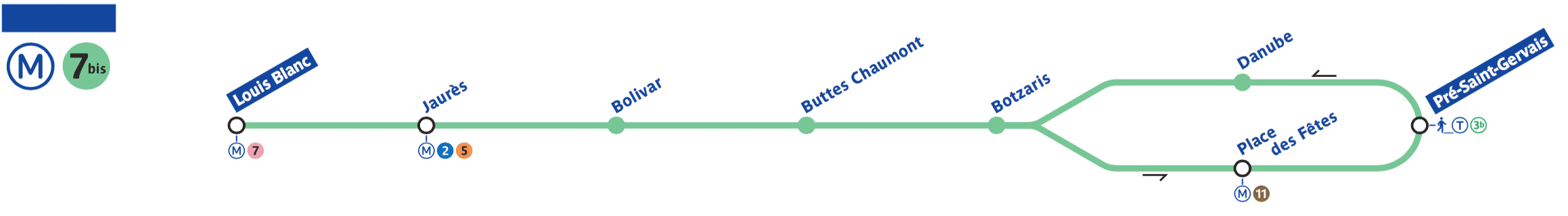
Paris Metro line 7bis map
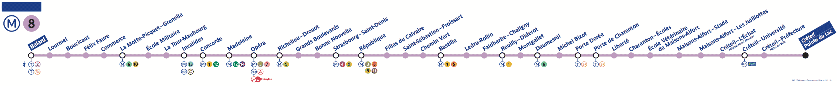
Paris Metro Line 8 Map
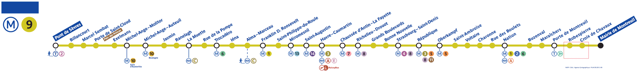
Paris Metro Line 9 Map
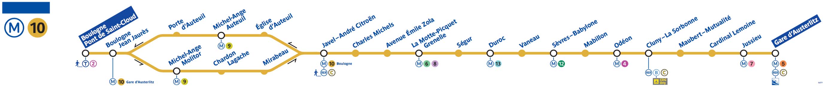
Paris Metro line 10 map

Paris Metro Line 11 Map
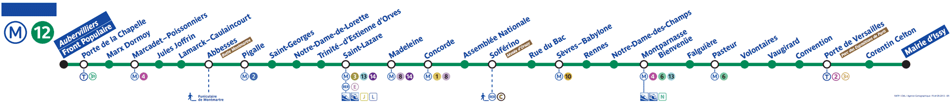
Paris Metro line 12 map

Paris Metro line 13 map
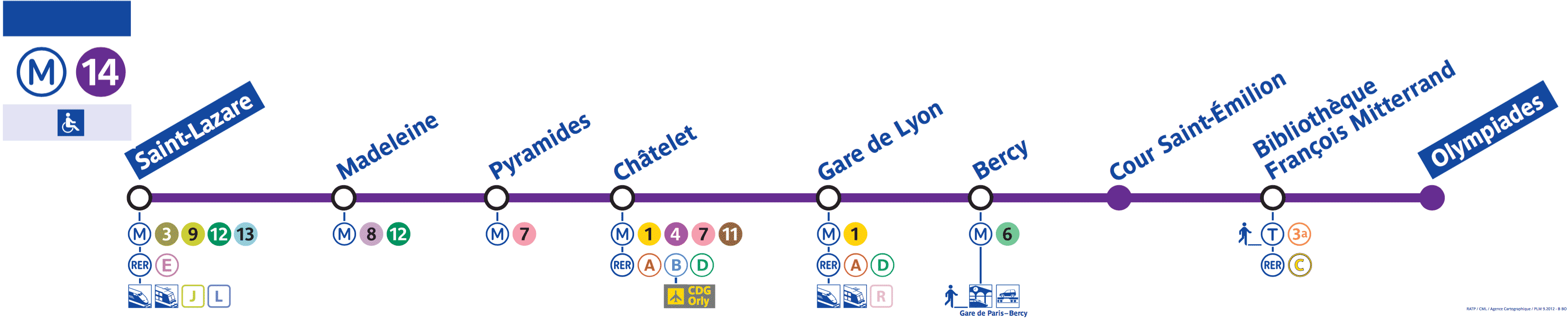
Paris Metro line 14 Map
What Next?
- Search:
- Ask a question

Hi my name is Ben and I’m the creator & author of Parisbytrain.com. I want to empower you with the knowledge & confidence to travel Paris like a local through personally researched, in-depth articles like CDG to Paris by train and the Paris Metro. I moved to Paris in 2006 and started Parisbytrain.com in 2008 to share what I’ve learned about the vast & comprehensive Paris train network. Have Paris train questions? Ask them here. Have a great visit to Paris!
I want to support Ben